Snow Observations List
Frequent shooting cracks, collapses, and whoomphs on wind drifted snow just north of town on a south facing aspect at 8,100ft.
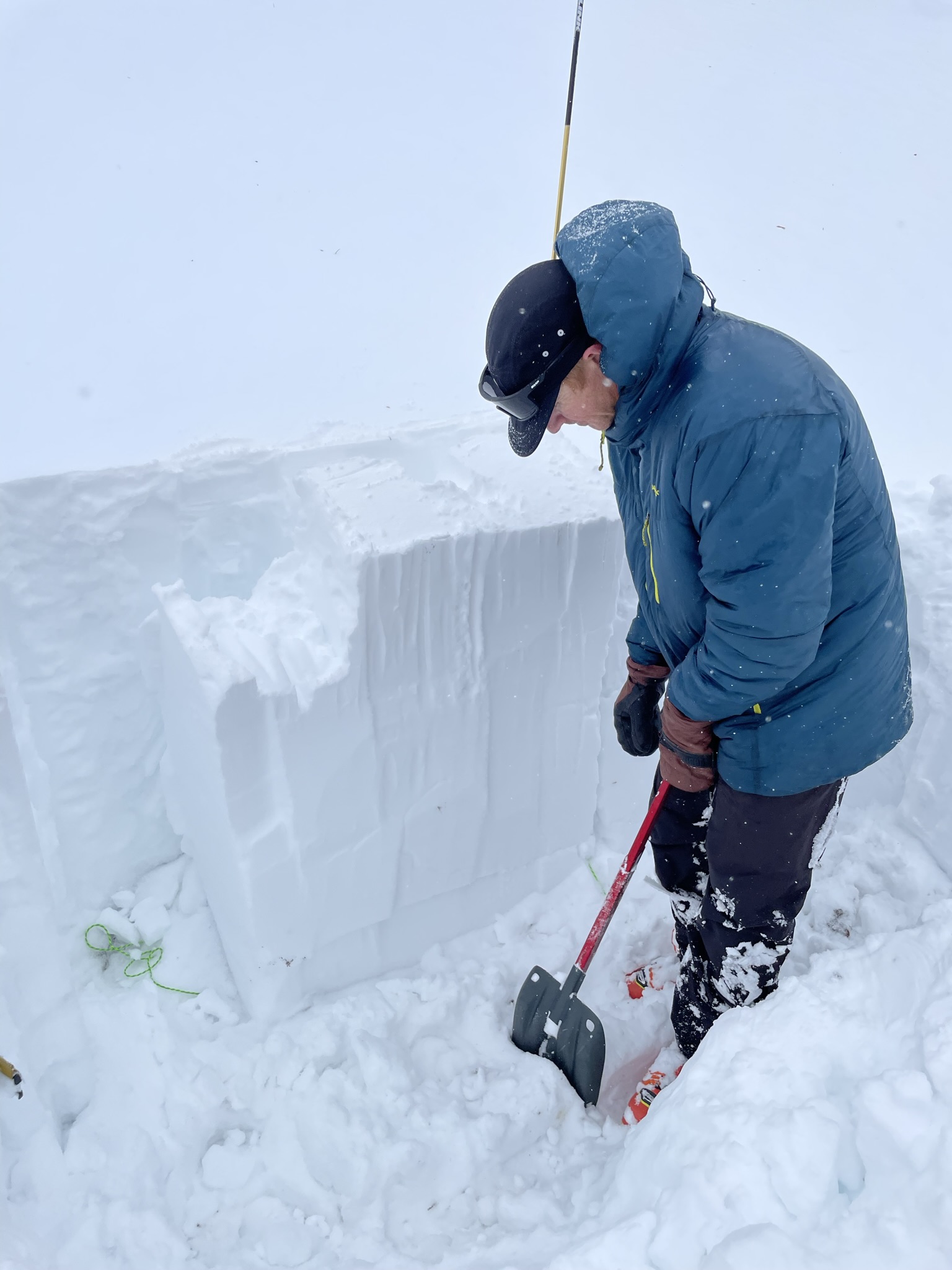
Full Snow Observation ReportWe skinned into the Divide Peak cirque to check out the conditions in Hyalite for the first time this season. On our tour we saw a couple of small R1-D1 slides that had broken within the new snow. At our first pit we saw HS at 124 cm with 10 cm of new snow. We had a ECTP 30 on facets 64 cm down from the surface. Next we dug on a SE aspect with a HS of 127 cm and 15 cm of new snow. We got an ECTN-3 within the new and old snow. More importantly, the wind was picking up throughout the day, and it was transporting snow. Our primary concern today was new snow, and in the next few days it will be wind drifted snow.
Full Snow Observation Report

The snowpack is getting punchy and soft, especially around rocks. The faceting has been taking a bit of a toll even though the snowpack is - relative to many Decembers - kind of deep.
It was very windy in the base aream, and there were strong southerly winds blowing all the way up past the top of Bridger. It looked like there was plenty of windloading in the usual areas for southerly winds (like that northerly-facing side of north bowl). Lots of plumes coming off the ridge, and Saddle looked like it was getting blasted pretty good. We are certainly thinking about a hardslab on top of facets in the future.
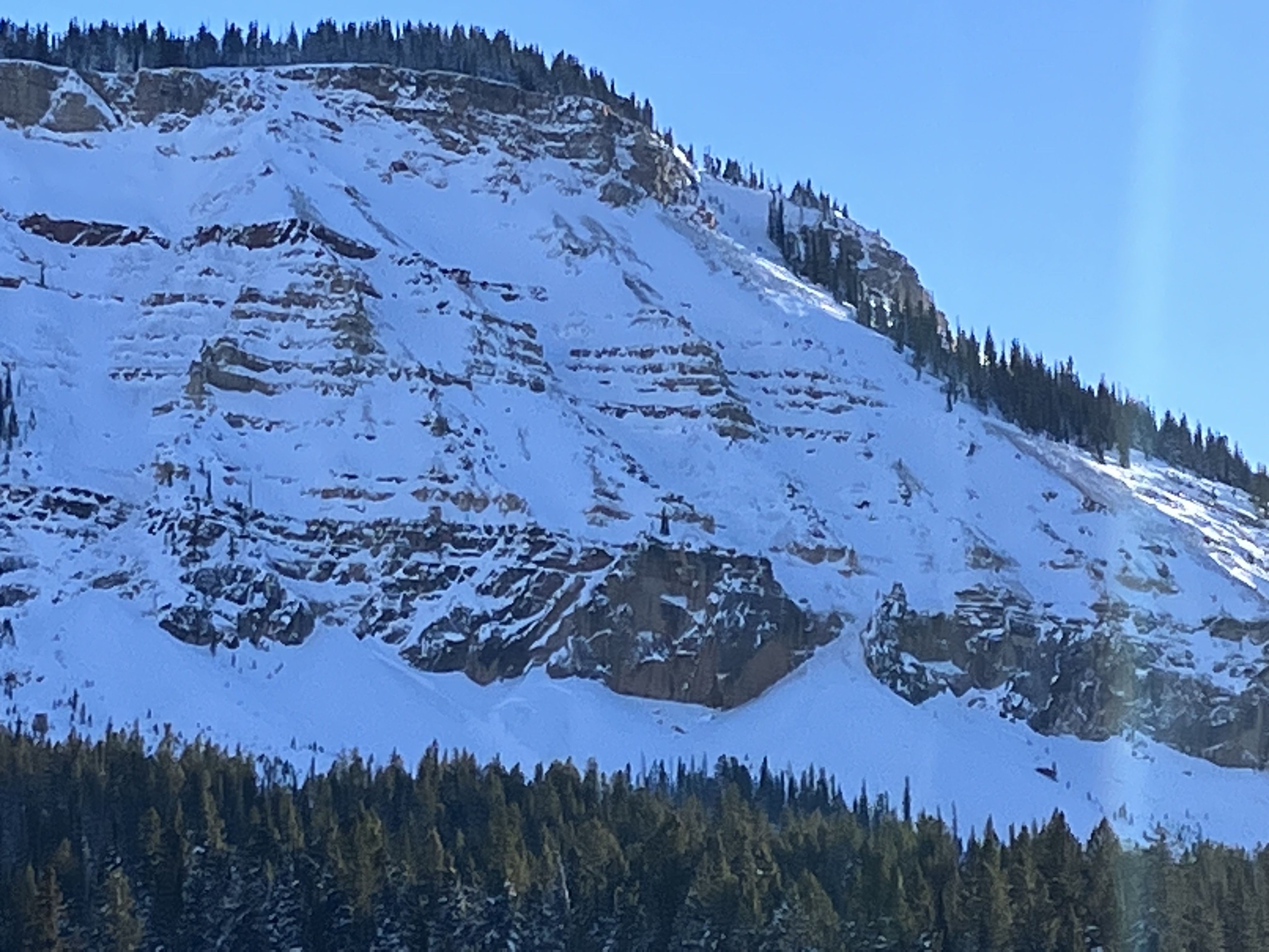
Full Snow Observation ReportObserved active windloading on the eastern side of Lick Creek today.
12-18 inch slab broke easily when ski cut and a small but very reactive cornice was rapidly building.
Full Snow Observation Report
West facing slope of Woody Ridge in Republic Creek. ECTn 21 at 65cm with a 120cm snowpack (8,842ft). Observed sugary facets close to the ground that did not react in our tests. No shooting cracks, collapses, or obvious signs of instability.
Full Snow Observation ReportCut a wind slab from the top of the John around 2:30. 3-6” crown. 50-75’ wide. Ran down to the low grade below
Full Snow Observation ReportTwo skiers triggered an avalanche while ascending the Banana Couloir on Ross Peak on the morning of 12/5/22. The skiers were approximately 150 ft from the top of the couloir when the avalanche broke 20 ft above the upper skier. The slide broke in wind drifted snow 6 inches deep and approximately 30 ft wide, across most of the couloir. The lower skier was waiting in a "safe spot on the side" but was also caught by the slide. The slide ran ~600 vertical feet, pulling out a deeper pocket of snow (1.5-2 ft deep) midway down the path. Both skiers were fully submerged as they were carried, but ended up partially buried near the toe of the debris. One skier had snow packed into his mouth and underneath his eyelids. They returned to the trailhead under their own power.
Full Snow Observation Report
Found facets sitting beneath a crust 60cm from the ground. Observed collapse on this layer in our pits but no propagation.
Full Snow Observation Report
Small avalanche below Henderson Bench. SE aspect. Likley Snowmobile-trigger did not confirm. 70-90’wide, 1-3’ crown, ran 40’
Full Snow Observation Report
Snow pack of 108cm on a 25 NE facing slope at 9,625'
Observed CT11 Q2 at new/old interface, 93cm, as well as an ECTN13 Q2 on what we believe to be a buried layer of surface hoar at 26cm. Also had some warming of the surface.
With the poor pit performance we decided to not ascend to the ridge and ski the intermediate terrain in the cirque, then out the drainage.
Full Snow Observation Report
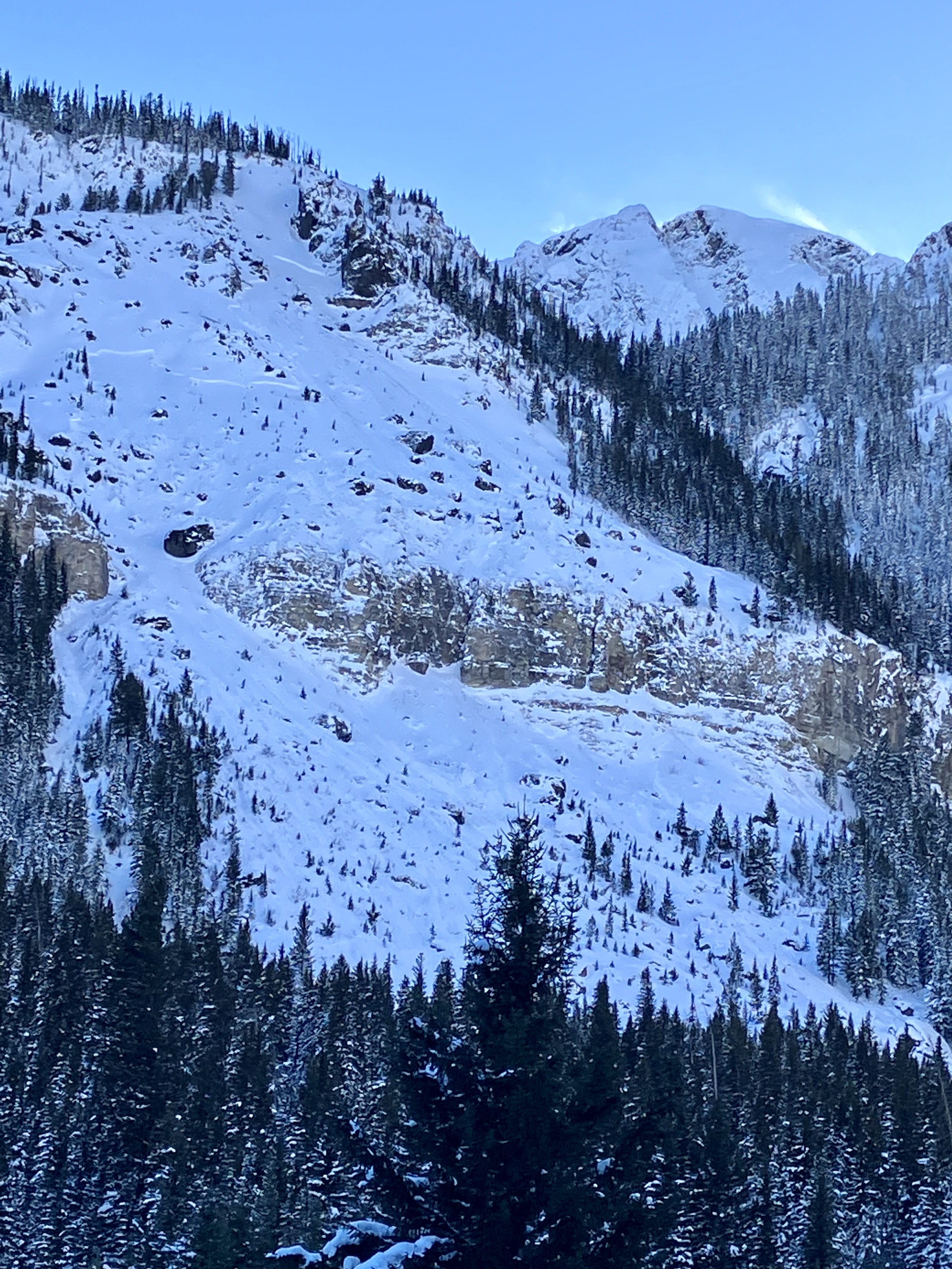
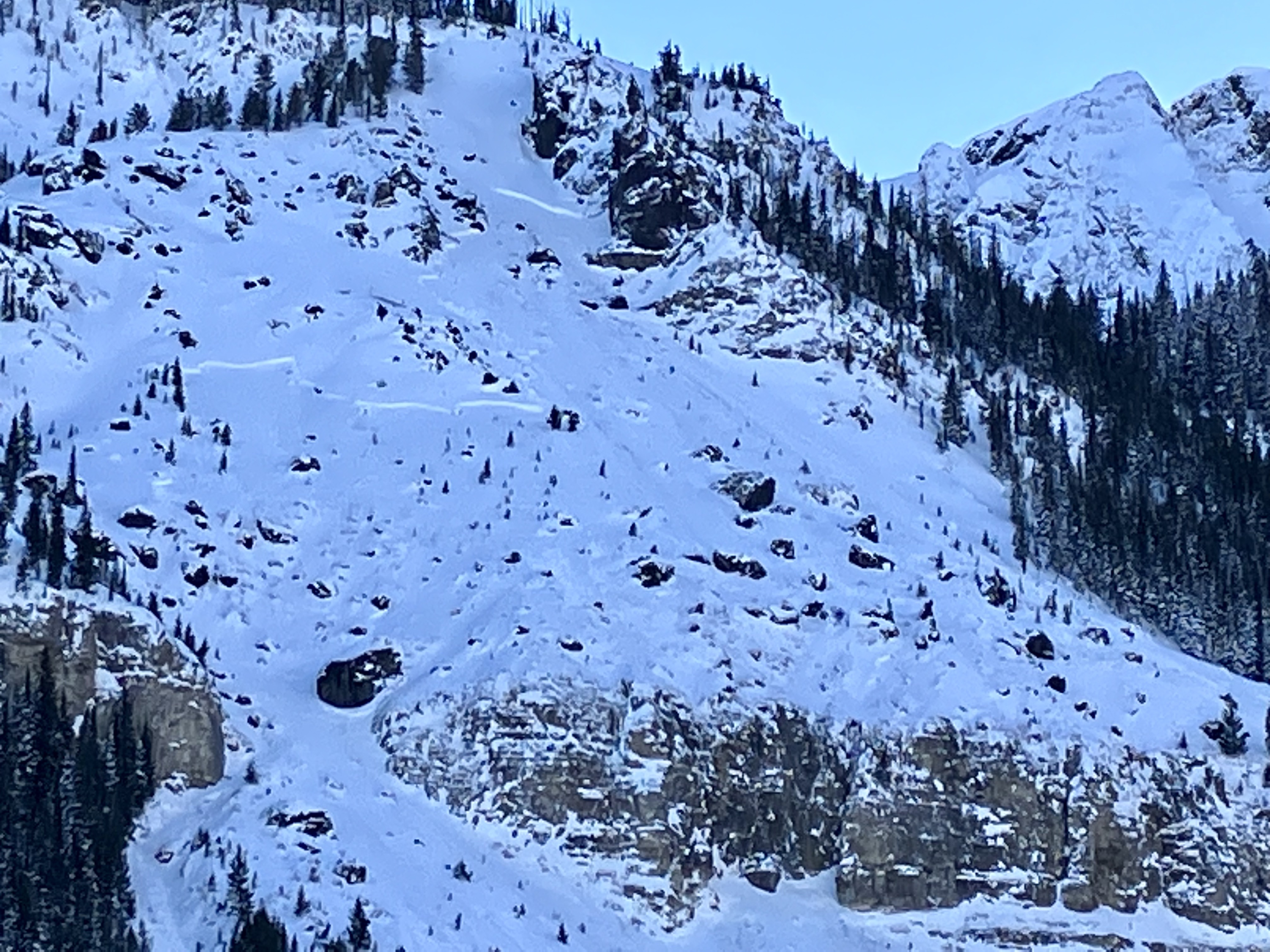
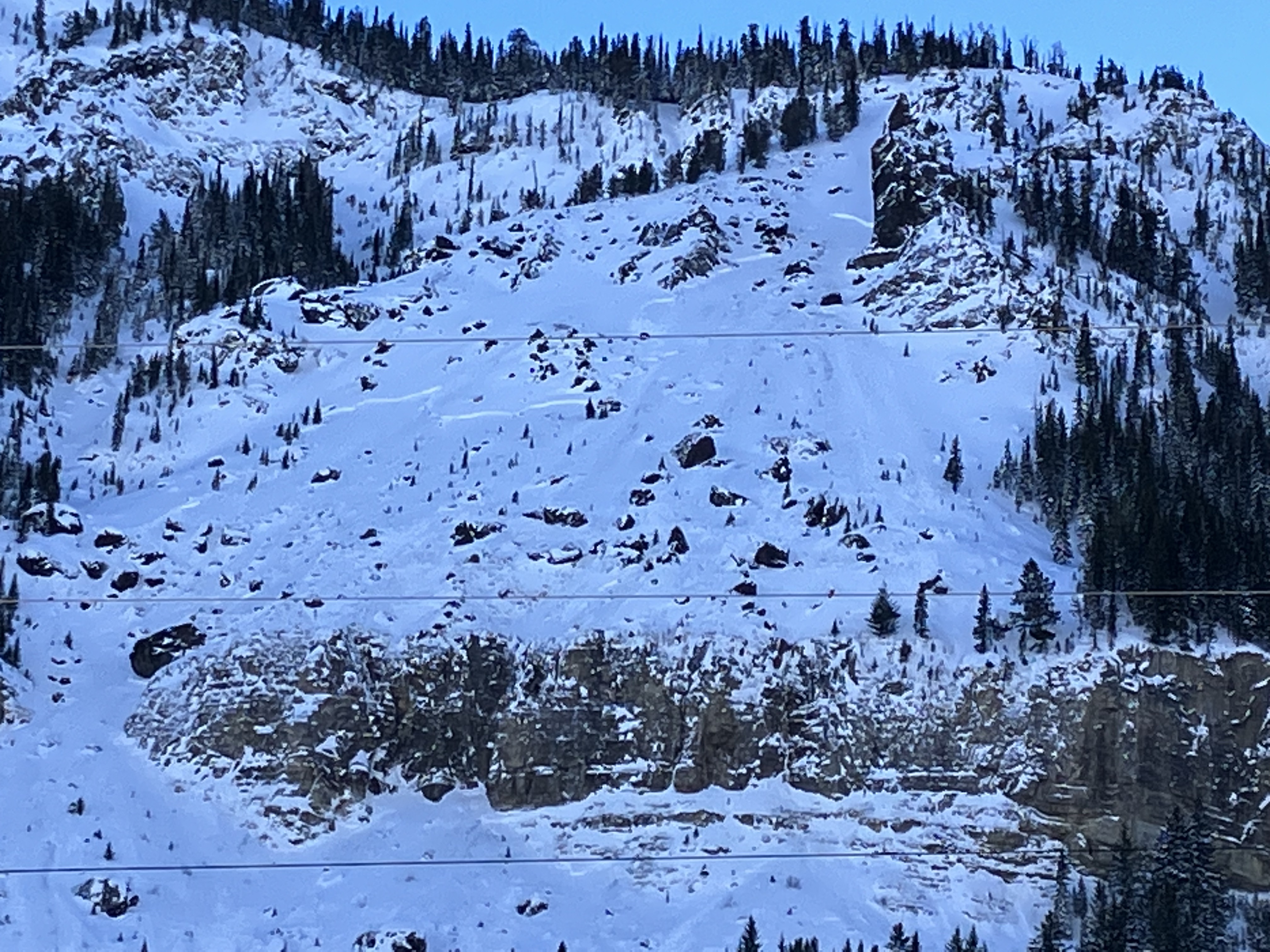
Here’s an avalanche we saw on December 2nd 2022 in cooke city on the north side of Henderson mountain just above lulu road.
Full Snow Observation Report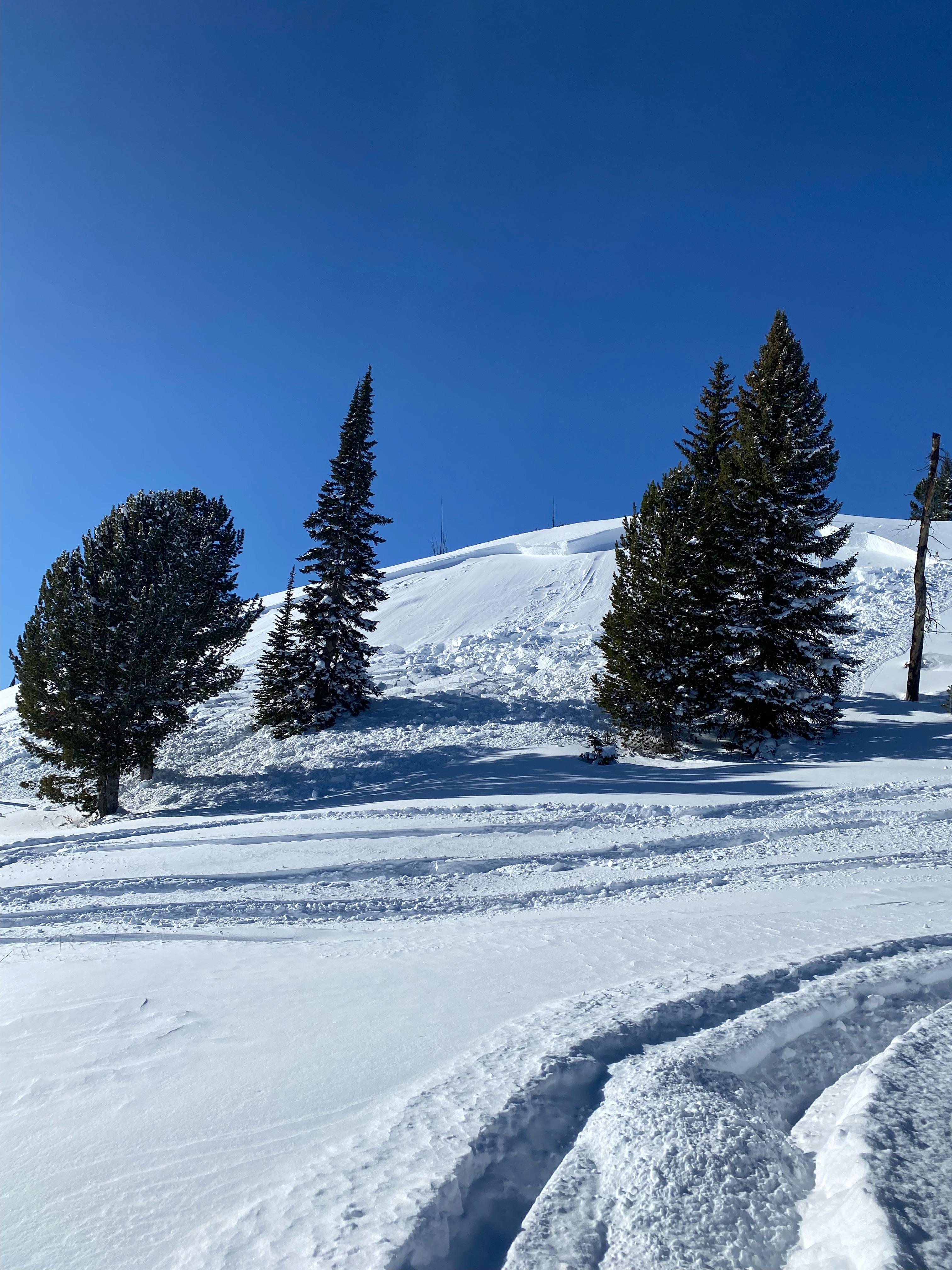

I toured in Lick Creek yesterday and thought I'd share a few things we noticed. Hopefully they are helpful observations!
While the skin track was still relatively flat and cutting through sloping meadows, we noticed a small sun crust on a southern aspect.
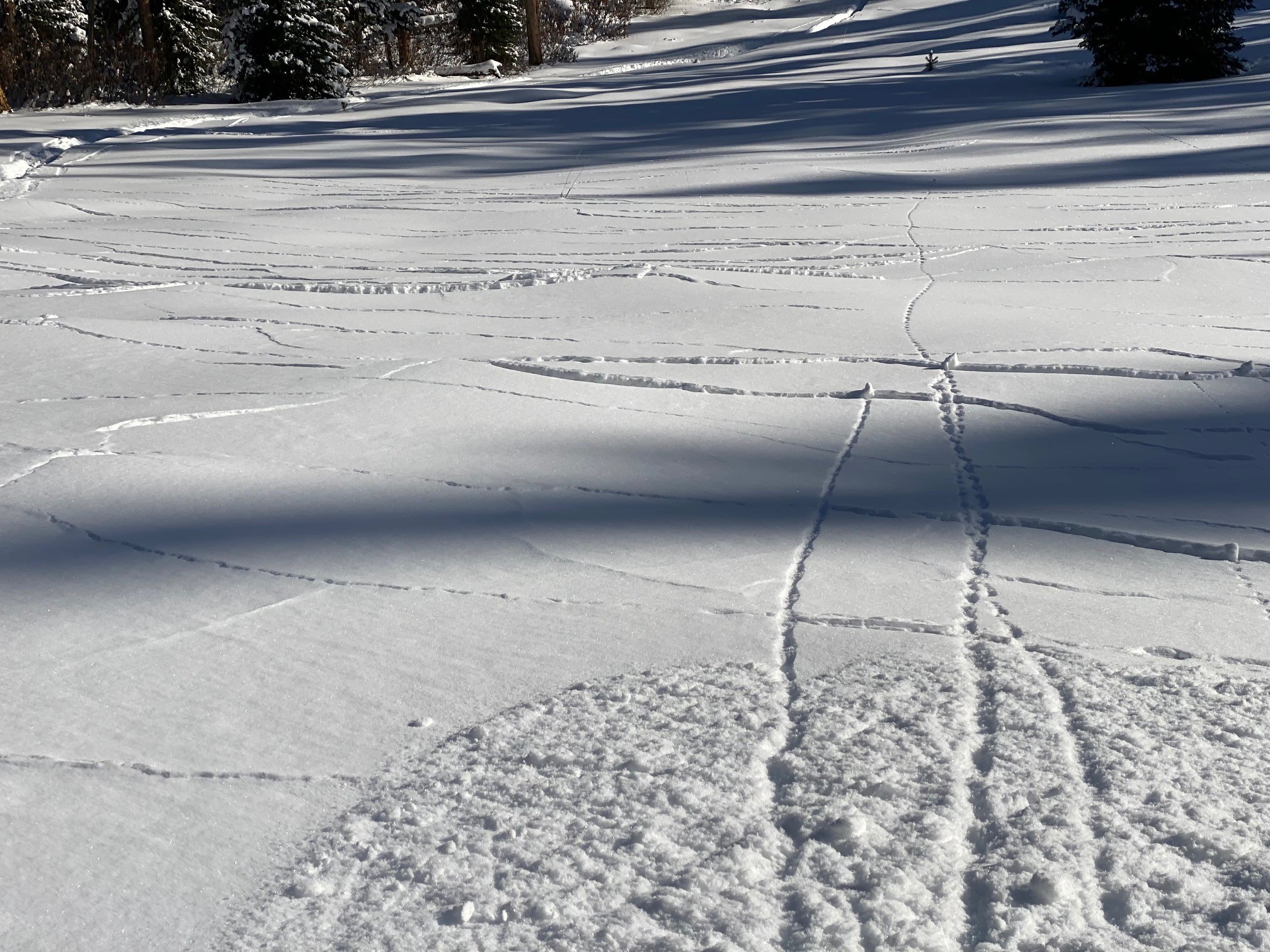
As we skinned through the front side skiing zone, we noticed evidence of wind affected snow. We found some strong layers that sounded hollow, sometimes underneath ~2 inches of snow. As we gained the ridgeline, the wind slab became more obvious. It cracked under my weight, but I didn't see any shooting cracks or distinct collapses.
Full Snow Observation Report
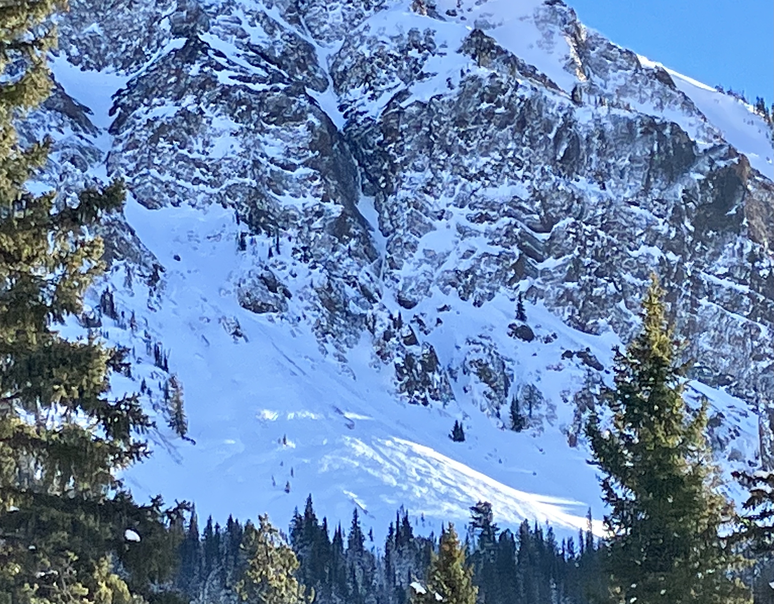
Toured up to Bacon Rind today and skied meadows off of the ridge. Noted many collapses and whumpfs in the snowpack as we ascended east aspects to the ridge. Looking toward Ernie Miller ridge, we noted an old crown in the main bowl just below the summit. It was on an E-NE aspect, 200 or more feet wide and looked to be filled in with new snow but was still visible. Looking east from the top of the ridge, we noted another crown on a west aspect that looked to be about 100' wide and deep.
Dug a pit at 8700' on a W aspect. HS was 70cm. We got an ECTP12 45 cm up from the ground at the interface between wind packed snow and a layer of .5-1mm facets and mixed forms. That layer made up the bottom 45cm of the snowpack in that area.
Dug another pit at 8800' on an E aspect. HS was 115cm. We got an ECTP 14 50cm up from the ground on that same interface as described above. The bottom 50cm of the snowpack looked to be facets and mixed forms. The upper 65cm in that area was a mixture of different layers of wind packed grains that ranged from F to 4F hardness.
Coverage on the descent is adequate, similar if not better than any point midwinter last season. Under skis, the snow in the burn/forest feels unconsolidated and very sugary.
Full Snow Observation Report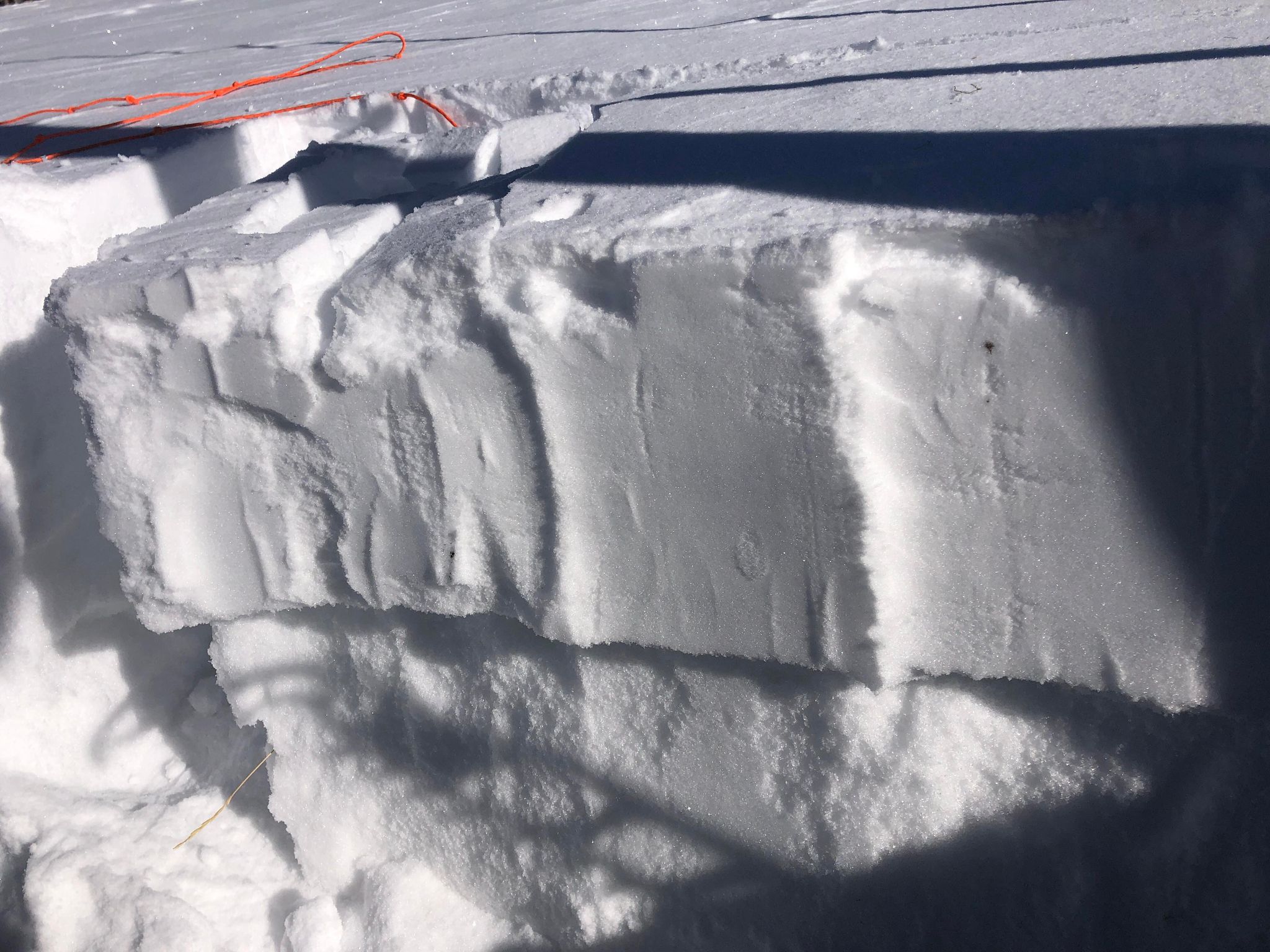

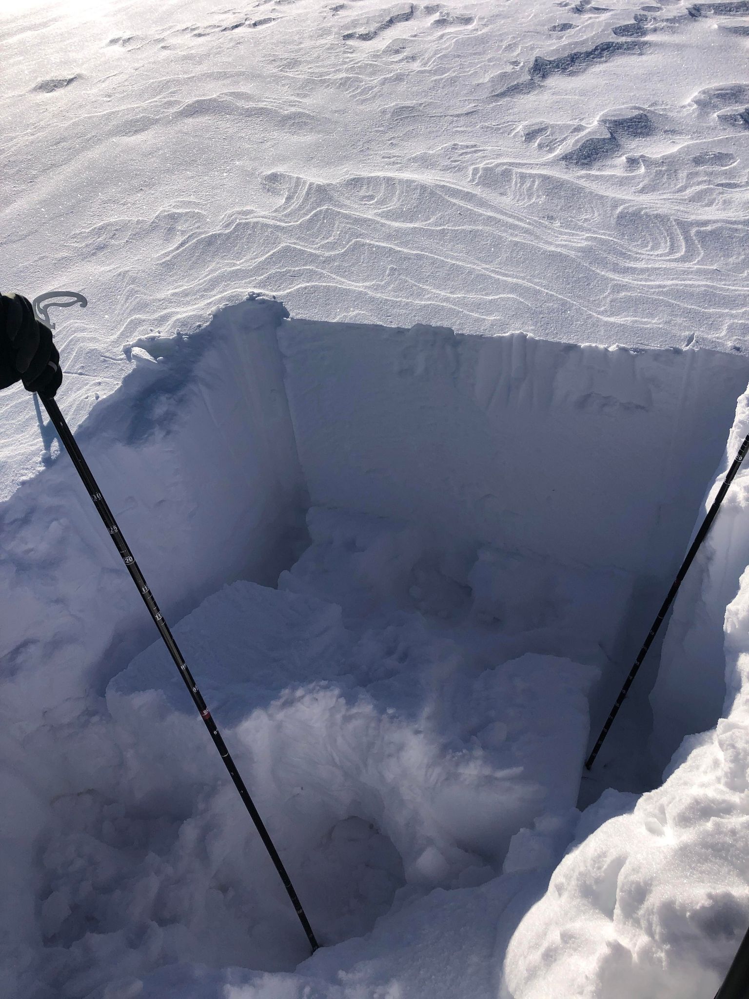
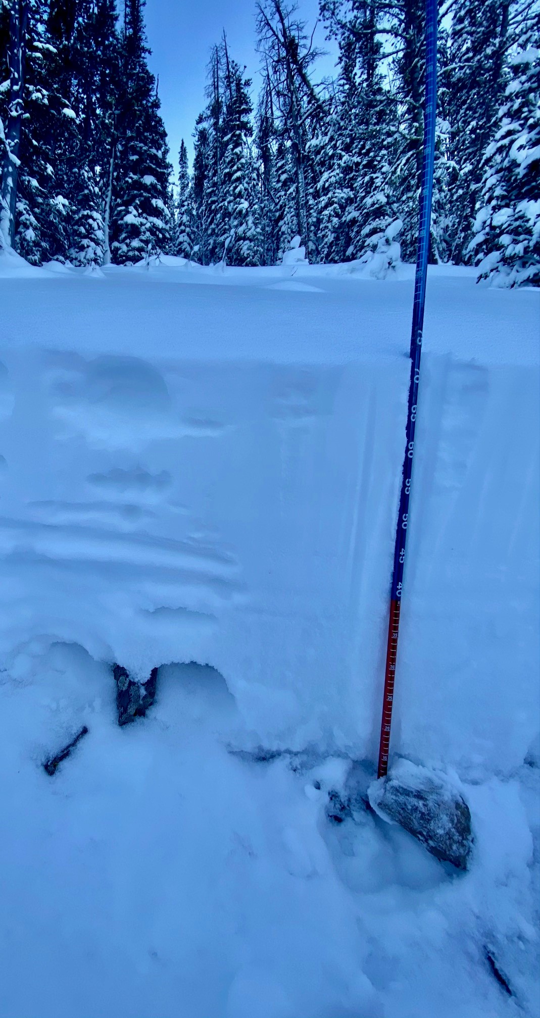
Early season snow recon outside of Maverick Mountain Ski Area boundary. Cracking of surface slab on easterly aspect at 8000 ft (see pics). Well developed weak layer about mid-pack that formed during November. Several storms the first week of December put down a 1-2 foot slab on top of this weak layer. Cohesiveness of slab varies by aspect and elevation. Wind and sun exposed slopes more reactive due to higher slab density. Areas protected from wind were not as reactive with no cracking experienced. Spatial variability is high with a shallow snowpack. See picture of quick pit showing major layering on north facing aspect at 8400 ft. Height of snow between 65-75 cm. Notable results were CTM 11 with a sudden collapse fracture character at 35cm up from the ground at November/December snow interface. ECTN 11 on same layer. The slab was not stiff enough in this protected location to propagate however this pit is representative of poor structure that is widespread.
Also, snowmobilers reported avalanches on some of the steep roadcuts on the Pioneer Scenic Byway.
Full Snow Observation Report
Large collapses on primarily solar aspects (S/SE, ~9,500’)
Ectx results on a north facing slope ~9,500’
Full Snow Observation Report

At the saddle between the front and backside of Lick Creek we found 110cm of snow with very dense windslabs. These were firm and cohesive, with the firmest being between 100 and 90cm. Our layer of most concern was at 65cm but was difficult to impact and we felt confident our weight alone even in shallow areas would not impact this layer, we skied the front side however due to time constraints.
Full Snow Observation Report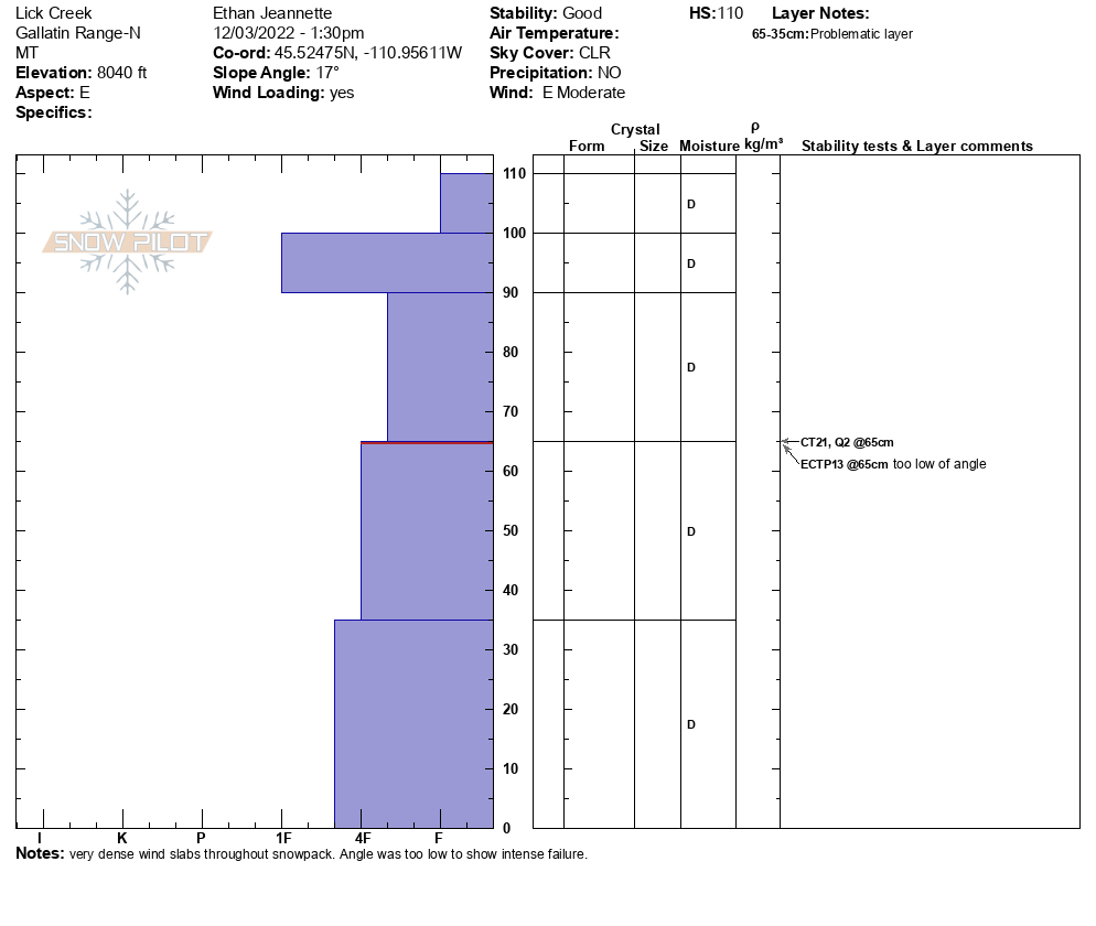
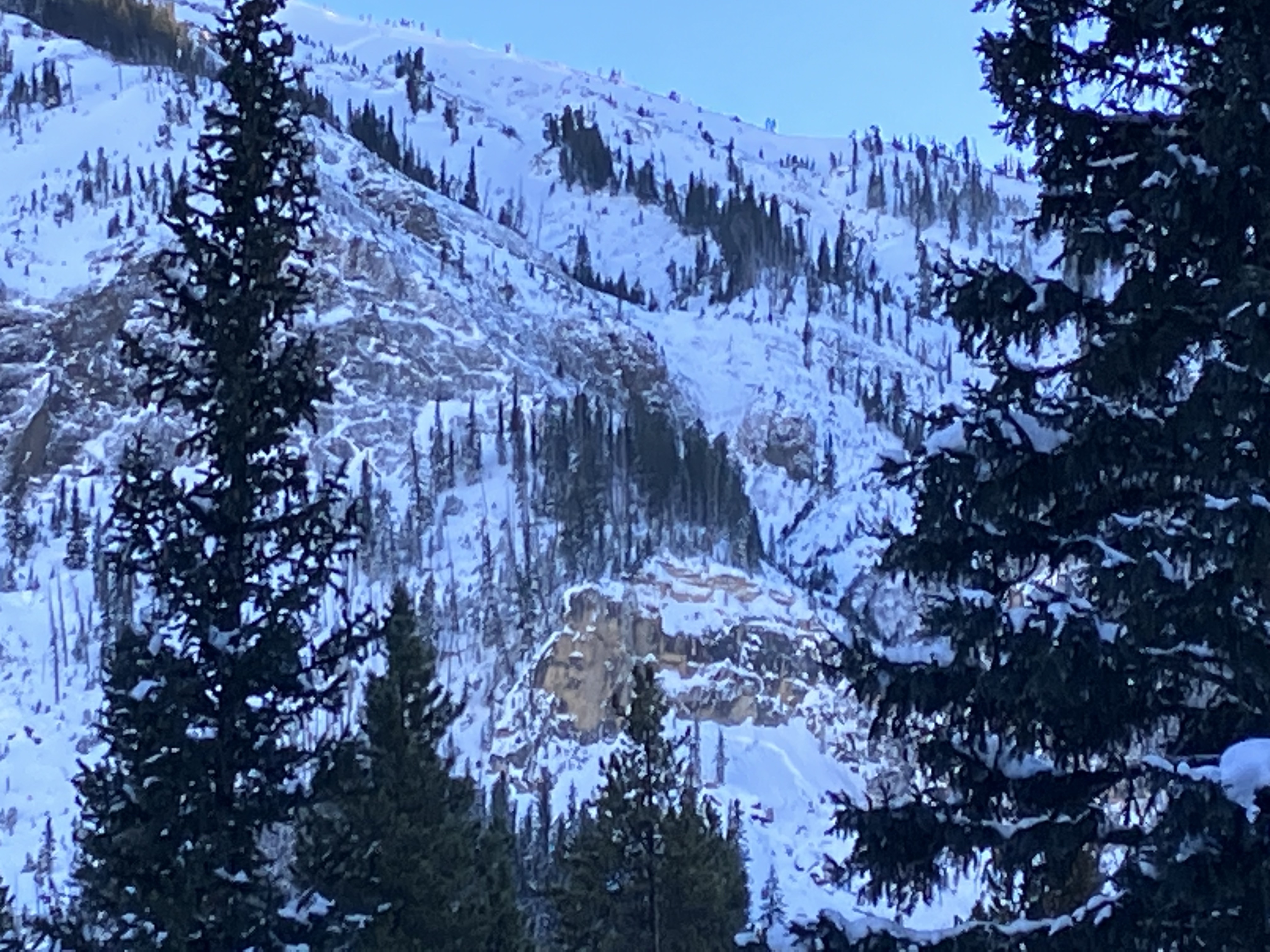
We toured to Ernie Miller today and saw a natural avalanche on a NE slope around 9600 ft. We heard and felt multiple collapses on our way in. We dug a pit on an east facing slope around 9300 ft where we found 105 cm of snow. We got a ECTN 2 result, failing on an interface about 15cm from the surface and ECTP5 failing 40 cm from the surface.
Full Snow Observation Report