Good morning. This is Ian Hoyer with the Gallatin National Forest Avalanche Forecast on Saturday, December 17th at 7:00 a.m. This information is sponsored by Grizzly Outfitters and Montana State Parks. This forecast does not apply to operating ski areas.
Please consider donating to the Friends of GNFAC Annual Fundraiser.
Two inches of new snow fell near Big Sky overnight, while the rest of the area stayed dry. Temperatures this morning are in the single digits and teens. Winds this morning are 15-20 mph out of the southwest and west (25 mph with gusts of 45 mph in the Bridger Range). Winds will increase this morning, especially north of Big Sky, blowing 25-35 mph with stronger gusts. Temperatures will rise into the teens and low 20s F under partly sunny skies. Light snowfall is expected to begin tomorrow night.

Newly formed and thickening wind drifts will easily avalanche today under the weight of a skier or rider. Yesterday, a skier triggered an avalanche that broke 2-4 ft deep and 150 ft wide in wind drifted snow on Saddle Peak (details and photo). Thankfully, while he was caught and carried 500 vertical ft he wasn’t buried or otherwise injured. Today is the sort of day that catches people off guard - there isn’t any new snow, but increasing winds are drifting the plentiful soft snow at the surface into fresh drifts. Wind drifts will avalanche today on steep slopes. Avoid these steep, wind drifted slopes.
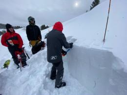
Avalanches can also break on weak layers deeper in the snowpack (Buck Ridge video, Mt Ellis video). Imagine if that avalanche on Saddle Peak had broken down into the weak layers that we know are there because Alex found them last weekend on the Football Field (video). It would have been several feet deeper and likely much wider and even more powerful. Dig to look for these layers before getting on any steep slope.
With increasing wind drifting today, human triggered avalanches are likely on wind-loaded slopes and the avalanche danger is CONSIDERABLE. The danger is MODERATE on all other slopes.

Avalanches breaking on the widespread weak layers buried 2-4 ft deep are our primary concern today. Without loading, these slides are slowly becoming less likely, but if they break, they’ll be large and powerful. Natural avalanches earlier this week near Cooke City show that these weak layers can’t yet be discounted (details). Terrain selection remains the best way to minimize your chance of triggering a large avalanche - by staying off of and out from under slopes steeper than 30 degrees (observation from an avalanche triggered from below last week). If you are going to ride steep slopes, dig to assess the weak layers first. Avalanches remain possible and the danger is rated MODERATE.
If you get out, please share avalanche, snowpack or weather observations via our website, email (mtavalanche@gmail.com), phone (406-587-6984), or Instagram (#gnfacobs).

Avalanches breaking on the weak layers buried 2-4 ft deep are our primary concern today. Without loading, these slides are slowly becoming less likely, but if they break, they’ll be large and powerful. Terrain selection remains the best way to minimize your chance of triggering a large avalanche - by staying off of and out from under slopes steeper than 30 degrees. If you are going to ride steep slopes, dig to assess the weak layers first.
Upcoming Avalanche Education and Events
Our education calendar is full of awareness lectures and field courses. Check it out: Events and Education Calendar.
TODAY! Saturday, December 17, 10 a.m., Avalanche Awareness - Winter Wonderland at Montana Science Center. More information HERE.
Monday, December 19, 5:30 p.m., Women in the Backcountry at MAP Brewing. Free.
Every Saturday, 10 a.m - 2:00 p.m. Avalanche Rescue Training, drop in for any amount of time. Round Lake Warming Hut, Cooke City. Free.
Send us your observations. They do not have to be fancy, just a few sentences. Did you see any avalanches? How much new snow? Is the wind blowing and drifting snow? Pictures, snowpits and stability test scores are also welcome, but not necessary. You can help us fill in the gaps of our field work.