Good morning. This is Ian Hoyer with the Gallatin National Forest Avalanche Forecast on Friday, December 2nd at 7:00 a.m. This information is sponsored by Blitz Motorsports and Yamaha and Avalanche Alliance. This forecast does not apply to operating ski areas.
*Note: Bridger Bowl Ski Area is closed and there are no avalanche control or ski patrol services. Backcountry conditions exist. Please don’t ski over hoses and power cords, stay off chairlifts, and give snowcats and snowmobiles plenty of room.
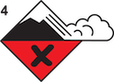
AVALANCHE WARNING
The Gallatin National Forest Avalanche Center is issuing a Backcountry Avalanche Warning for the Lionhead Area near West Yellowstone, MT and Centennial Mountains near Island Park, ID. Two feet of new snow and very strong winds are creating very dangerous avalanche conditions. Natural and human triggered avalanches are likely. Avalanche terrain and avalanche runout zones should be avoided. The avalanche danger is rated HIGH on all slopes. Contact the Gallatin National Forest Avalanche Center for more detailed information.
This warning will expire or be updated by 6:00 a.m. on Saturday, December 3, 2022.
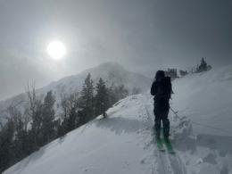
Since yesterday morning, there are 18” of new snow (with 1.9” snow water equivalent) in the Lionhead area, 8-10” (0.8-1.1” SWE) in Taylor Fork and Cooke City , and 5-8” (0.2-0.4” SWE) near Bozeman and Big Sky. Winds were 20-40 mph with gusts of 40-75 mph out of the south and west yesterday. Overnight winds shifted to the north and west and decreased dramatically, but are still gusting up to 30 mph. Temperatures are in the single digits and teens F this morning. Winds will remain moderate out of the north and west today. The bulk of the snowfall is over, but another inch or two may fall this morning as the storm passes.
Avalanche Warning
Two feet of new snow and winds gusting up to 75 mph have created very dangerous avalanche conditions. Avoid traveling on or beneath any steep slopes. If you get onto a steep slope you will trigger an avalanche or one could break all by itself above you. Avalanches may break within the storm snow or deeper and wider on weak layers that have been severely overloaded (video). Drifting snow will continue today, adding additional load to windloaded slopes. The avalanche danger is HIGH on all slopes.

Over the past 48 hours, over two feet of new snow fell around Cooke City with strong winds (see Alex’s video from yesterday). Human triggered avalanches are likely on all slopes, especially wind loaded ones. Snowfall stopped this morning and we just barely avoided an avalanche warning. The avalanche hazard is very serious today and cautious route finding is essential for safe travel. The avalanche danger is CONSIDERABLE.
A foot of new snow fell onto a weak snowpack over the last two days. A widespread weak layer beneath the new snow will make avalanches break easily. The avalanche danger is CONSIDERABLE.

5-8” of light density snow fell overnight. Watch out for areas where the new snow has drifted into deeper cohesive slabs. It’s still early season so we don’t have too much confidence in the lower snowpack yet - dig before getting into avalanche terrain to make sure there isn’t a buried weak layer hiding down there. For today, the avalanche danger is rated MODERATE.
If you get out, please share avalanche, snowpack or weather observations via our website, email (mtavalanche@gmail.com), phone (406-587-6984), or Instagram (#gnfacobs).
Avalanche Warning
Two feet of new snow and very strong winds have created very dangerous avalanche conditions. Decision making is easy today - simply avoid traveling on or beneath any steep slopes. If you get onto a steep slope you will trigger an avalanche or one could break all by itself above you. Avalanches may break within the storm snow or deeper and wider on weak layers that have been severely overloaded
Upcoming Avalanche Education and Events
Our education calendar is full of awareness lectures and field courses. Check it out: Events and Education Calendar.
Monday, December 5, 6:30-7:30 p.m. @MAP Brewing in Bozeman, Know Before You Go avalanche awareness presentation.
Tuesday, December 6, 9 a.m. - 3:00 p.m. West Yellowstone Avalanche Fundamentals w/ Snowmobile Field Session. Pre-register HERE.
Thursday, December 8, 6 - 7:30 p.m., Free Snow & Avalanche Safety Workshop: Belgrade Community. This workshop will cover the basics of snow and avalanche equipment. Belgrade Community Library. A raffle and pizza will be included!
Monday, December 12, 5-8 p.m. @MAP Brewing, Movie Night.
Tuesday, December 13, 6 p.m., Avalanche Awareness + Beacons at Story Mill Park. Free.
The Friends of the Avalanche Center are hosting the Powder Blast Fundraiser. Your donations support free and low-cost avalanche education, beacon checkers at trailheads, beacon parks, weather stations, and GNFAC programs! The Friends of GNFAC launched an online GoFundMe campaign. Please consider a donation, and we look forward to having an in-person event again in the future.