This is Doug Chabot with pre-season avalanche, weather and event information from the Gallatin National Forest Avalanche Center on Saturday, November 5th. This information is sponsored by The Friends of the Avalanche Center and Grizzly Outfitters. Join them in supporting free and low-cost avalanche education, community outreach and avalanche center operations during the 2022 Virtual Powder Blast.
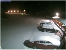
In the last 24 hours the mountains around West Yellowstone and Cooke City received 10” of snow, and it’s still snowing. Areas around Big Sky, Hyalite and the Bridger Range got 2-3”. Wind is averaging 15-30 mph with gusts hitting 50. It is blowing out of the SE in the Bridger Range and SW-W everywhere else. Today, expect another inch or two in the northern areas and 6” in the southern mountains. Winds will remain strong with temperatures in the 20s F. A little snowfall Sunday night will turn into a snowstorm on Monday. Stay tuned, and in the meantime put fresh batteries in your beacon, test your airbag and dust off your helmet. Winter’s footsteps are getting louder.
Wind and snow are a dangerous combination. In the southern mountains the snowpack doubled in the last 24 hours to 20+ inches. In the northern mountains there was less new snow, but close to 20” is on the ground. Wind will be blowing snow into drifts which will be easy to avalanche. All windloaded slopes should be avoided. Hunters are at risk crossing windblown gullies and skiers are at risk as they search for the deepest snows. I expect to hear of human triggered slides in the next week and hope no one gets caught.
It is avalanche season which means we treat a 20” snowpack in November as you would a 6 foot deep pack in February. The rules are the same. Go with a partner, analyze the snowpack and carry working rescue gear. Early season has 2 extra hazards: be prepared to get raked over rocks if you get caught in a slide and remember that we are a tad rusty traveling in avalanche terrain.
Your observations are more important than ever this time of year as we get to know this season’s snowpack.
If you get out, please share avalanche, snowpack or weather observations via our website, email (mtavalanche@gmail.com), phone (406-587-6984), or Instagram (#gnfacobs).
The Centennial Mountains outside of Island Park received 10” in the last 24 hours doubling the snowpack. Wind will be blowing snow into drifts which will be easy to avalanche. All windloaded slopes should be avoided. Go with a partner, analyze the snowpack and carry working rescue gear. Early season has 2 extra hazards: be prepared to get raked over rocks if you get caught in a slide and remember that we are a tad rusty traveling in avalanche terrain.
Our education calendar is full of awareness lectures and field courses. Check it out: Events and Education Calendar.
The Utah Avalanche Center Snow and Avalanche Workshop is a great opportunity available online from 6-9 PM on November 9.
We are offering an Avalanche Fundamentals with Field Session course for skiers in December and January, and snowmobilers in early January. Sign up early before they fill up.
Friends of GNFAC Powder Blast Fundraiser
The Friends of the Avalanche Center are hosting the Virtual Powder Blast fundraiser. Your donations support free and low-cost avalanche education, beacon checkers at trailheads, beacon parks, weather stations, and GNFAC programs! The Friends of GNFAC launched an online GoFundMe campaign. Please consider a donation, and we look forward to having an in-person event again in the future.


