Good morning. This is Dave Zinn with pre-season avalanche, weather and event information for the Gallatin National Forest Avalanche Center on Monday, November 29th. This information is sponsored by Uphill Pursuits and Gallatin County Search and Rescue. We will update this bulletin on Friday, December 3rd.
In the Madison and Bridger Ranges, 1-2” of snow fell Friday night while the rest of the advisory area remained dry for the weekend. West to southwest winds ramped up Sunday to 20-40 mph with gusts in the 60s mph and largely above freezing temperatures. This week, temperatures will stay below freezing in the southern ranges while the northern ranges will reach the 30s and 40s F during the day. Moderate to strong winds from the southwest will return to the mountains Tuesday afternoon. There is a chance for 1-2” of new snow Monday night, but we have to wait for the weekend for our next chance for significant precipitation.

All Regions
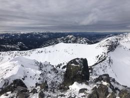
While the long fall continues in the valleys of Southwest Montana, this season’s snowpack is developing in the mountains (albeit painfully slowly) and we are well into avalanche season. This weekend skiers in Beehive Basin and Hyalite Canyon observed small slab avalanches resulting from recent wind loading and pinwheels that indicate surface snow warming (Beehive photo, Hyalite 1, 2). Strong winds through the middle of the week will drift soft snow into unstable slabs that you should avoid. The better coverage found on wind-drifted slopes may entice us, but this is where avalanches are most likely to occur.
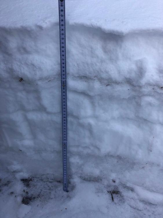
While the snowpack structure varies on the slope scale, we know weak layers, like the one that Alex describes in his video from Cooke City, exist across the advisory area. Skiers are reporting them from snowpits in the Bridger, Gallatin, and Madison Ranges (Photo 1, 2). Carefully evaluate snowpack stability and the consequences of getting caught in an avalanche with sharp rocks just inches below you. Terrain traps such as trees, cliffs, rocks, and gullies exacerbate these consequences.
We appreciate the observations you all have submitted this season. You are helping us develop a more complete understanding of this season’s snowpack by submitting observations here. Now, THINK SNOW!
We are preparing for winter, teaching avalanche classes, and setting up weather stations. If you have avalanche, snowpack or weather observations to share please submit them via our website, email (mtavalanche@gmail.com), phone (406-587-6984), or Instagram (#gnfacobs).
Upcoming Education Opportunities:
Get your avalanche brain ready for the season at one of the many classes listed on our education calendar, and list of upcoming events below. Don’t delay preparing and inspecting your avalanche gear. Get some tips from Dave Zinn in this Pre-Season gear check video.
November 30, 7-8 pm, Online Free 1 hr Avalanche Awareness in partnership with The Yellowstone Club Community Foundation. Link to Join Here.
December 1, 6-8 pm, Avalanche Awareness and Beacons at Beall Park. More info on our education calendar.
Our popular Avalanche Fundamentals with Field Course is perfect as a refresher or an introduction to avalanches. We are introducing an exciting new format this year with the four lectures pre-recorded to watch at your convenience, a live question and answer session, and a choice of a snowmobile or ski/ board based field day occurring the following three weekends.
Friends of GNFAC Powder Blast Fund-raiser
The Friends of the Avalanche Center are hosting the Virtual Powder Blast fundraiser. With only $3,800 left to go, help us reach the $65,000 goal. Your donations support free and low-cost avalanche education, beacon checkers at trailheads, beacon parks, weather stations, and GNFAC programs!
Doug was interviewed by Justin Angle for Montana Public Radio about his background, avalanches, and his work in Central Asia. You can listen to the interview HERE.