Good Morning. This is Dave Zinn with the Gallatin National Forest Avalanche Forecast on Wednesday, April 7th at 6:45 a.m. Today’s forecast is sponsored by Gallatin County Search and Rescue. This forecast does not apply to operating ski areas.
Bridger Bowl is closed and backcountry conditions exist. There is no avalanche mitigation or ski patrol rescue. Please stay clear of work areas, snowmobiles, chair lifts and other equipment.
The mountains picked up 1-2” of snow with 4” in Hyalite before the storm ended yesterday morning. Temperatures are in the 20s F with 10-20 mph winds from the southwest to northwest. Summer will return for the day with mountain temperatures in the 40s to low 50s F, 5-15 mph wind from the southwest and mostly sunny skies.

All Regions
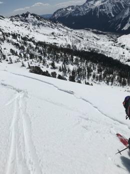
Monday afternoon through Tuesday morning the mountains received 0.4-0.6” of precipitation except for the Northern Gallatin Range and the Taylor Fork, which received 1.0-1.2”. At higher elevations, this equaled 5-10” of snow with less at lower elevations where precipitation began as rain. Our avalanche concerns also vary by elevation. Yesterday, we rode into the Taylor Fork. The low elevation snowpack was an unsupportable, wet mess with small wet avalanches on steep cut banks in contrast to upper elevations where a thick crust supported us and the primary concern involved avalanches from drifts of new snow (video).
Today, rising temperatures and sunny skies will create two problems:
- The new snow will get wet and easily slide on the crust below. These avalanches will not be very deep, but the heavy snow will pack a punch.
- Crusts that formed during cooler temperatures the last two days will begin to break down, and larger wet slab avalanches will be possible (wet slab video). This concern will start in lower elevations and sunnier aspects and expand through the day. Sunday’s natural wet slab up the Main Boulder, outside our advisory area, is a good example of this hazard (photo).
Managing wet snow avalanches is a matter of timing (wet snow timing video). Be out the door early and off steep slopes before temperatures rise and the sun blasts the snow. The snowpack will be generally stable other than isolated wind slabs while it is cold and frozen and will become unstable as the surface snow gets moist and the underlying crust breaks down.
Due to changing stability throughout the day, the danger is rated MODERATE and human-triggered avalanches possible.
If you get out, please send us your observations no matter how brief. You can submit them via our website, email (mtavalanche@gmail.com), phone (406-587-6984), or Instagram (#gnfacobs).
Upcoming Avalanche Education and Events
See our education calendar for an up-to-date list of all local classes.
We will end regular forecasts this weekend and will begin issuing weather, snowpack and avalanche updates every Monday and Friday as well as updates to social media through April. Avalanches will still be possible if there is snow on the ground. Remain vigilant with safe travel practices and snowpack assessments for the duration of your ski season.