Good Morning. This is Dave Zinn with the Gallatin National Forest Avalanche Forecast on Tuesday, March 30th at 7:15 a.m. Today’s forecast is sponsored by Spark R&D and the Gallatin Valley Snowmobile Association. This forecast does not apply to operating ski areas.
The winds eased off yesterday evening and this morning they are blowing 10-20 mph from the west, temperatures are in the single digits F and there is 1-2” of new snow. Today, temperatures will be in the upper teens to low 20s F, winds will be 5-15 mph from the west to northwest and snow this morning will deliver 1-2” before tapering off mid-day.

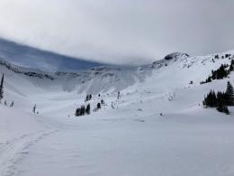
All Regions
There are three distinct avalanche concerns across the advisory area today.
- Fresh Drifts of snow and wind-loaded slopes: For the last two days southwest to northwest winds blasted the mountains with gusts regularly reaching 70-85 mph with a peak of 104 mph at the summit of Big Sky two nights ago (Wolverine Peak wind-loading, Big Sky wind transport photo). Winds stripped some slopes of all available soft snow and deposited drifts 1-3’ deep on others. Drifted slopes avalanched naturally on Saddle Peak in the Bridger Range, near Maid of the Mist (video) in Hyalite Canyon, and on Iceberg Peak near Cooke City and under the weight of skiers on Miller Mountain. Avoid steep slopes with on-going wind-loading or large pillows of recently drifted snow where small to large avalanches are possible.
- Persistent weak layers near the ground: This weekend skiers triggered an 8-10’ deep avalanche near Mount Blackmore (photos and details), others observed a natural deep-slab avalanche near Flanders Creek (photo), and snowmobilers triggered an avalanche that broke near the ground in McAtee Basin (photo and details). These are the first three slides to break on sugary snow at the base of the snowpack since February. Slides like this are a low probability, high consequence event and avoiding steep, complex slopes is the safest management strategy until this layer has fully adjusted to recent loading.
- Weak interface under recent snow: A weak layer of near-surface facets formed on some slopes, but not all, and was buried under 2-4’ of snow during the last 10 days. Skiers triggered avalanches at the interface between the old and new snow 7-10 days ago on Mount Blackmore (photo and details), Alex Lowe Peak (photos and details), and Hyalite Peak (photos and details) and we found it on some slopes around Buck Ridge (video) and Cooke City (video). It hasn’t been reacting recently, but it is worth digging down and performing a quick stability test at this interface before committing to any steeper terrain (How-To Video).
Human-triggered avalanches are possible today and the avalanche danger is rated MODERATE.
If you get out, please send us your observations no matter how brief. You can submit them via our website, email (mtavalanche@gmail.com), phone (406-587-6984), or Instagram (#gnfacobs).
Upcoming Avalanche Education and Events
See our education calendar for an up-to-date list of all local classes. Here are a few select upcoming events and opportunities to check out:
April 5, 6:30 p.m., Forecaster Chat with Alex Marienthal, hosted by Uphill Pursuits, “Spring Snowpack and Forecasting Tools”. Link to Join.
On Sunday a skier was killed in an avalanche in Alaska. Details are limited. We are sad to hear of this loss which is the 36th avalanche fatality in the US this season.