Good Morning. This is Ian Hoyer with the Gallatin National Forest Avalanche Forecast on Saturday, March 7th at 7:00 a.m. Today’s forecast is sponsored by Montana State Parks and Beartooth Powder Guides. This advisory does not apply to operating ski areas.
There is no new snow this morning. Today starts out warm, dry, and mostly sunny. Winds are 10-30 mph out of the south and west with gusts of 30-50 mph. Temperatures are hovering around freezing. High temperatures today will be in the high 30s to 40s F. Winds will be 15-30 mph out of the SW. This afternoon a cold front will bring clouds and the chance of a brief drizzle before switching over to snow. Expect 1-3” of snow overnight.
WET AVALANCHES
With another very warm day in store, wet avalanches are the primary concern. Yesterday, numerous small wet slides were seen from the Bridgers to West Yellowstone (details). With only a light freeze overnight, surface crusts will break down quickly this morning on sunny slopes. Be alert as the snow surface becomes wet. If you’re sinking deeper than your ankles into wet snow, avoid steep slopes (video). Slides may break only in top few inches or gauge deeper, especially where the snowpack is thin and weak. Plan to be off steep, sunny slopes by the early afternoon, especially if the sun doesn’t become obscured by clouds. Across our entire advisory area, the wet snow avalanche danger will rise to MODERATE as surface crusts break down.

The weak snow near the ground remains problematic in the northern Gallatin Range, particularly on slopes with a thin snowpack. The likelihood of triggering a slab is decreasing with each day, but it is still possible. Skiers got unstable snowpack test results on this weak snow yesterday near Mount Ellis, indicating that despite the warm temperatures, the snowpack hasn’t stabilized yet. If you find the wrong spot, you could trigger a slide similar to last week’s groomer triggered avalanche in Swan Creek (video, video, details). Dig a snowpit to look for and test these weak layers before riding steep slopes. The dry snow avalanche danger is MODERATE today.
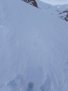
Aside from wet snow, the snowpack is generally stable across the rest of the advisory area. This doesn’t mean all slopes at 100% safe. Be on alert for isolated pockets of instability. Especially if you’re getting into steeper, bigger, more consequential terrain. On Thursday, skiers on Skyline Ridge had a windslab crack and collapse as they approached the bottom of a steep chute (details). They listened to this sign and backed off the slope. Collapsing cornices are another concern. Minimize your time exposed below them and stay back from the edge if you’re above them. For today, the dry snow avalanche danger is rated LOW.
If you get out, please send us your observations no matter how brief. You can fill out an observation form, email us (mtavalanche@gmail.com), leave a VM at 406-587-6984, or Instagram (#gnfacobs).
Upcoming Avalanche Education and Events
Our education calendar is full of awareness lectures and field courses. Check it out and plan to attend one or two: Events and Education Calendar.
COOKE CITY
Every Friday and Saturday, Snowpack Update and Rescue Training. Friday, 6:30-7:30 p.m. at the Soda Butte Lodge. Saturday anytime between 10-2 @ Round Lake.
BOZEMAN
March 26, GNFAC Forecaster Chat: Spring Travel and Wet Snow Avalanches, 6-8 p.m. at Uphill Pursuits.
BILLINGS
March 12, 1-hr Avalanche Awareness, 6-7 p.m. at The Basecamp.
Check out this cool website from the National Snow and Ice Data Center that gives a snapshot of the season’s snowfall across the western US.