Good Morning. This is Doug Chabot with the Gallatin National Forest Avalanche Forecast on Thursday, March 5th at 7:00 a.m. Today’s forecast is sponsored by Montana Alpine Guides and Alpine Orthopedics. This advisory does not apply to operating ski areas.
Yesterday the mountains around Cooke City picked up 2-3” of new snow while everywhere else got missed. Wind blew strong out of the west all day with gusts near 80 mph. Last night skies cleared and west winds lessened to 10-15 mph with gusts of 30 mph. Temperatures are in the teens this morning and will rise into the low 40s under mostly sunny skies and light west wind. Tomorrow will be even warmer.
WET AVALANCHES
Today’s sunny skies and warm temperatures will increase the wet snow avalanche danger. Slopes getting direct sunshine will begin melting. Signs of instability in the moist surface snow are pinwheels rolling downhill, loose, wet point release avalanches, and sinking past your boot tops in wet snow. This is the first day of sunny skies, exceedingly warm temperatures, and mostly calm wind, a trio of factors that will wet the top foot of snow and increase wet avalanche activity. Ian made a video yesterday about today and tomorrow’s wet avalanche potential. For today, throughout our entire advisory area, the wet snow avalanche danger will rise to MODERATE on all sun exposed slopes.

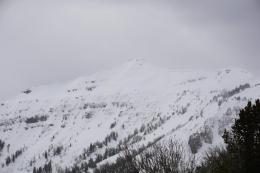
The northern Gallatin Range is harboring weak snow near the ground that is unstable. This layer consists of large grains of sugary facets called depth hoar. Six days ago a large avalanche was triggered on this layer by a snowcat groomer (details). Six days is a while go, but stability tests continue to show this weak layer failing. Skiers saw it on thin areas of Mount Ellis two days ago, and yesterday I dug on an adjacent slope to the groomer-lanche with unsatisfactory results. The column broke cleanly in 2 of my 3 tests (video). Although the likelihood of triggering slides is decreasing, it is doing so at a slower rate than other mountain ranges. Many slopes are stable, but some are not. The most unstable snow is found on slopes with less than 4 feet of snow, so dig and assess before committing. For today, the dry snow avalanche danger is MODERATE since avalanches are still possible.
Excluding the northern Gallatin Range, evidence of recent instability is lacking in our forecast area. The most current avalanche activity with a buried weak layer was 8 days ago in Hourglass Gully in the Bridger Range (photo), and over 2 weeks ago in the other ranges. The Weather and Avalanche Log has all the details. Today, around Cooke City, there may be a few wind-drifts from yesterday’s 2-3” that could break, but these would be small and isolated occurrences. Throughout southwest Montana, cornices are drooping heavily and ready to break free, often times much farther back than we can imagine. We’ve gotten alarming reports of skiers getting dangerously close to the edges. Besides pummeling you in a fall, breaking cornices have killed when they trigger avalanches. Given the widespread weak layer of sugary facets in the bottom of the snowpack, this scenario is not out of the question. For today, without any new snow or wind-loading, dry snow avalanches are unlikely and the danger is rated LOW.
If you get out, please send us your observations no matter how brief. You can fill out an observation form, email us (mtavalanche@gmail.com), leave a VM at 406-587-6984, or Instagram (#gnfacobs).
Upcoming Avalanche Education and Events
Our education calendar is full of awareness lectures and field courses. Check it out and plan to attend one or two: Events and Education Calendar.
COOKE CITY
Every Friday and Saturday, Snowpack Update and Rescue Training. Friday, 6:30-7:30 p.m. at the Soda Butte Lodge. Saturday anytime between 10-2 @ Round Lake.
BOZEMAN
March 6 and 7, She Jumps Companion Rescue Clinic, Fri 6-8 p.m. and Sat 10a-2p. More info and Register HERE.
BILLINGS
March 12, 1-hr Avalanche Awareness, 6-7 p.m. at The Basecamp.
MSU film student, Nate Kenney made Propagation, a video that profiles GNFAC forecaster Alex Marienthal and highlights what we do at the Avalanche Center. Thanks, Nate! Nice job.