Good Morning. This is Dave Zinn with the Gallatin National Forest Avalanche Forecast on Tuesday, February 11th at 7:00 a.m. Today’s forecast is sponsored by Map Brewing and Ph.D. Skis. This forecast does not apply to operating ski areas.
This morning temperatures are in the single digits above and below zero, winds are 15-20 mph from the west in the northern ranges and in West Yellowstone and Cooke City winds will be 5-15 mph from the south. 1” of new snow fell yesterday morning before it tapered off. Today, winds will pick up in the northern ranges from the west at 25-35 mph. Near Cooke City and West Yellowstone winds will be 15-25 mph from the west to southwest. High temperatures will be in the teens to low 20s F. Tonight the mountains around Cooke City will get 4-6” of new snow, around Bozeman and Big Sky 3-5” and West Yellowstone will get a trace to 2”.

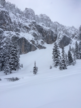
Increasing winds today will form fresh drifts out of last week’s 50-60” of snow that will crack and avalanche in steep terrain. While the new avalanche problem to watch for today will be wind-loaded slopes, we aren’t out of the woods from the largest loading event of the year (3-4.5” of snow water equivalent in the last seven days). Indeed, it was just 24 hours ago that the mountains around Big Sky and Bozeman reported up to a foot of new snow. Two days ago, Alex searched the Bridger Range for the fallout from the storm and said, “It would be easier to list the steep slopes that didn’t avalanche than those that did.” This included one avalanche in Truman Gulch that broke over a mile wide (photos, video) and a slide that broke naturally across Saddle Peak failing 4-8’ deep (photo, video). Photos and reports continue to come in from observers in the Northern Gallatin, Madison, and Bridger Ranges documenting trees snapped of by the force of slides and huge debris piles far down in runout zones (photos page, avalanche log).
Dangerous avalanche conditions continue today as increasing winds load slopes with fresh drifts of snow and the snowpack slowly adjusts to snow from the last week. Cautious route-finding and conservative terrain choices are essential. Human triggered avalanches are likely, and the danger is rated CONSIDERABLE on all slopes.

While not a green light, the snowpack around Cooke City and West Yellowstone is adjusting well to the 2-3’ of snow in the last week and the avalanche danger is coming down. Doug and I spent the last two days riding through the Lionhead and Southern Madison regions and the most remarkable thing we saw was the lack of significant natural and human triggered avalanche activity (Lionhead video, Taylor Fork video). We noted several avalanches within the new snow and when the wind picks up, there is a lot of ammunition to rapidly build drifts of snow that will avalanche. Skiers and riders in Cooke City reported similar conditions observing avalanches that failed during and immediately after the storm breaking 2-3’ deep and sensitive wind drifts breaking 4-6” deep (photo, 2, 3, 4).
Human triggered avalanches are possible, and the danger is rated MODERATE. Assess the snowpack for instabilities, be obsessed with the consequences of a slide before committing to avalanche terrain, and avoid slopes recently loaded by the increasing wind.
If you get out, please send us your observations no matter how brief. You can fill out an observation form, email us (mtavalanche@gmail.com), leave a VM at 406-587-6984, or Instagram (#gnfacobs).
Upcoming Avalanche Education and Events
Our education calendar is full of awareness lectures and field courses. Check it out and plan to attend one or two: Events and Education Calendar.
COOKE CITY
Every Friday and Saturday, Snowpack Update and Rescue Training. Friday, 6:30-7:30 p.m. at the Soda Butte Lodge. Saturday anytime between 10-2 @ Round Lake.
BOZEMAN
March 4, 1-hr Avalanche Awareness. 6-7 p.m. at REI.
WEST YELLOWSTONE
February 22, 1-hr Avalanche Awareness. 7-8 p.m. at West Yellowstone Holiday Inn.
Make it a daily habit to check out our Weather and Avalanche Log. It’s a great way to get a quick snapshot of what’s been happening in the backcountry.