Good Morning and Happy New Year. This is Doug Chabot with the Gallatin National Forest Avalanche Forecast on the first day of 2020, at 7:30 a.m. Today’s forecast is sponsored by Cooke City Super 8/Bearclaw Bob’s and Stronghold Fabrication. This forecast does not apply to operating ski areas.
At 5 a.m. the mountains around Bozeman, Big Sky and Cooke City have 3-5” of new snow while the southern ranges to West Yellowstone have 6-8”. Winds are west to southwest at 20-35 mph with gusts of 60 mph in Hyalite. Temperatures are in the low 20s F in the north and 10 F in the south. Today, winds will lessen to 20 mph and temperatures will cool to the teens and single digits. By tonight an additional 4-6” will fall with 8” in Cooke City.

The southern mountains from Big Sky to West Yellowstone got 6-8” of snow measuring .6” of snow water equivalent (SWE). At the ground is a thick layer of unstable and sugary snow that will struggle to support the weight of today’s snowfall. Also, the new snow will not bond well to the old snow surface. Snowfall and strong wind are creating dangerous avalanche conditions. If you venture onto or underneath steep slopes you are likely to trigger an avalanche. For today the avalanche danger is rated CONSIDERABLE on all slopes.
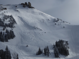
The Bridger Range has 5” of new snow (.6” SWE) while the northern Gallatin and northern Madison Ranges received 3-4” (.3” SWE). Winds have been strong out of the west and gusting to 60 mph at the Hyalite weather station. The new snow will not adhere very well to the old snow surface (small, faceted grains and surface hoar). This was evident yesterday in Hyalite when skiers triggered a shallow wind slab from afar (photo) and an ice climber got hit with a large loose snow avalanche (details). North of Bridger Bowl, Ian got cracks shooting out from his ski tips in wind-drifted snow (video). For today, new snow and wind are creating a CONSIDERABLE avalanche danger on wind-loaded slopes. Slopes without a wind load will have a MODERATE danger. Avoid all slopes with wind-drifted snow and turn around if you see shooting cracks or avalanche activity.
The mountains around Cooke City have 3” of new snow and southwest wind blowing 10-25 mph. Snowfall and wind will continue today and slopes that are wind-loaded are the biggest concern. The new snow will not bond well to the old surface and this interface is where most avalanche activity will occur. Additionally, there is weak snow at the ground which will become increasingly stressed from the weight of today’s snow. Avalanches from Friday (details) and our field investigation on Sunday and Monday show the potential for deep avalanches that could be triggered from thinner areas of a slope (video of recent activity on Henderson, video of Mt. Abundance). For today, avoid slopes that have been recently wind-loaded and stick to lower angled terrain. The avalanche danger is rated CONSIDERABLE on wind-loaded slopes and MODERATE on all others.
If you get out, please send us your observations no matter how brief. You can fill out an observation form, email us (mtavalanche@gmail.com), leave a VM at 406-587-6984, or Instagram (#gnfacobs).
Upcoming Avalanche Education and Events
Our education calendar is full of awareness lectures and field courses. Check it out and plan to attend one or two: Events and Education Calendar.
COOKE CITY
Every Friday and Saturday, Snowpack Update and Rescue Training. Friday, 6:30-7:30 p.m. at the Soda Butte Lodge. Saturday anytime between 10-2 @ Round Lake.
WEST YELLOWSTONE
January 4, 1-hr Avalanche Awareness, 7-8 p.m. at West Yellowstone Holiday Inn.
January 25, 1-hr Avalanche Awareness, 7-8 p.m. at West Yellowstone Holiday Inn.
BOZEMAN
January 7, Women's Specific Avalanche Awareness + Beacons, 6-8 p.m. at Story Mill.
January 8, 1-hr Avalanche Awareness, 6-7 p.m. at REI.
January 8, 1-hr Avalanche Awareness, Gallatin Valley Snowmobile Association Groomer Building.
January 10 & 11, Companion Rescue Clinic, 6-8 p.m. on the 10th at REI and 10-2 p.m. on the 11th at History Rock. More info and Register Here.
January 15 and 16, Introduction to Avalanche w/ Field Course, evenings of January 15 & 16 plus one field day either January 18, 19 or 25. Snowmobile specific field day offered January 25. More info and Register Here.
The Lionhead Weather Station is up and running! You can access the data here.