This is Doug Chabot with pre-season avalanche, weather and event information for the Gallatin National Forest Avalanche Center on Monday, November 18th. Today’s update is sponsored by Grizzly Outfitters and Spark R&D. Our next bulletin will be issued on Thursday.
*Note: Bridger Bowl Ski Area is closed and there is no avalanche control or ski patrol services. Backcountry conditions exist. Workers are setting up for the season and making snow. Please stay clear of work areas, snow guns, chair lifts and other equipment.
A small storm Friday night dropped 3-4” of snow in the northern ranges and 1” in the south. Last night it rained to 9,000’ in the north and snowed 1-3” in the south. This morning mountain temperatures are in the mid-20s to mid-30s with W-SW wind blowing 15-30 mph. Today will be mostly cloudy with another storm tomorrow morning into Wednesday. The storm will start as rain and turn to snow later Tuesday. By Wednesday afternoon the mountains will have 3-5” of new snow. Thursday through the weekend is forecast to be dry and mild.
We will update our Weather Log and Regional Conditions every morning with snowfall totals, and our Avalanche Activity list if we get a report.

All Regions
Winter handed the reigns back to fall. In one week’s time we went from temperatures below zero to rain. Since Thursday's bulletin the northern Gallatin and Big Sky area picked up 3-5" of dense snow on Friday and .3” of rain last night while cold temperatures in the south allowed it to snow 1-3”. Rain followed by temperatures below freezing is good for the stability, but not so good for skiing. Slopes above 9,000’ got snow, so if you are willing to trudge through low and mid-elevation glop, you’ll be rewarded.
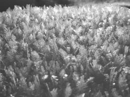
In general, snow stability is good. In the mountains there is 2-2.5 feet of snow and our pits and public observations point to a relatively stable snowpack of crusts and strengthening snow. On Saturday, skiers on Mt Blackmore (photo) and Hyalite Peak (photo) found no instability.
Looking ahead to Tuesday and Wednesday’s storm, stability concerns will be confined to new and windblown snow throughout our advisory area. The storm will start warm and then cool which should help it adhere to the old snow surface. Wind with the storm will create drifts so be attune for shooting cracks, a sign of instability. Our limited field data shows slopes to be generally stable, but we need more information. If you'd like to help us you can quickly fill out an observation form and attach a picture or two. You can also email us (mtavalanche@gmail.com), leave a message on our phone (406-587-6984) or Instagram (#gnfacobs).
Upcoming Avalanche Education and Events
Our education calendar is full of awareness lectures and field courses. Check it out and plan to attend one or two: Events and Education Calendar.
BOZEMAN
20 November, 1-hr Avalanche Awareness, 7-8pm @ The Mountain Project.
4 & 5 December, Introduction to Avalanche w/ Field Course, Evenings of December 4 & 5 plus one field day either December 7, 8 or 14. Snowmobile specific field day offered December 14. More info and Register Here.
HELENA
23 November, Helena Snowdrifters, Avalanche Awareness and Partner Rescue Training, 9am-3pm at the Mako Building in Helena.
BILLINGS
TOMORROW, 19 November, 1-hr Avalanche Awareness, 6-7pm @ The Base Camp in Billings.
BUTTE
TOMORROW, 19 November, 1-hr Snowmobile Avalanche Awareness, 6-7pm @ Redline Sports in Butte.
Here's a funny video I saw about Search and Rescue that made me laugh.