This is Dave Zinn with pre-season avalanche, weather and event information for the Gallatin National Forest Avalanche Center on Friday, November 8th. This update is sponsored by tonight’s Ullr & Skadi Fest and Swiss Fit Montana.
*Note: Bridger Bowl Ski Area is closed and there is no avalanche control or ski patrol services. Backcountry conditions exist. Workers are setting up for the season and making snow. Please stay clear of work areas, snow guns, chair lifts, and other equipment.
The last week began with snow and mountain temperatures in the 20s F, but the dominant weather for the week was temperatures in the 30s and 40s F with clear skies. This trend will continue through Saturday before a cold front returns us to winter.
On Sunday, the mountains around Bozeman and Cooke City will receive 1-3” of snow, and Big Sky and West Yellowstone will get a trace of snow. Saturday night temperatures will fall into the 20s F, and winds will be from the west to southwest at 10-20 mph.
We will update our Weather Log and Regional Conditions every morning with snowfall totals, and our Avalanche Activity list if we get a report.

All Regions
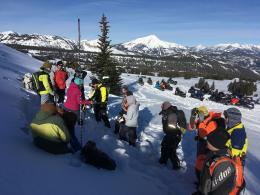
The mountain snowpack is generally stable with a mixed bag of riding conditions (Photo). The Bridger Range received 4” of snow equal to 0.4” snow water equivalent (SWE) on Monday with reports of rain up to 9600’ on Mount Blackmore. On a quick tour to Bridger Bowl Tuesday morning, I found dry snow on north-facing slopes, but things warmed up quickly as I left for the day. By Tuesday afternoon skiers reported wet loose snow avalanches in the Bridger Range (Photo). With mountain temperatures forecast into the 40s F through Saturday, pay attention to warming at the snow surface. If snowballs are rolling downhill and you observe wet loose avalanches, find shadier areas to play or go fishing for the afternoon. Be wary of small avalanches that could push you into obstacles or hazardous terrain.
As winter temperatures and snowfall return on Sunday, look to see how the new snow is bonding. This week’s high pressure weakened the snowpack in some areas changing the foundation into weak facets (Photo). If you are touring and break through to the ground, reach down and look for large, sugary snow crystals that will not stick together. These facets are generally stable without new snow. As the next snowstorm adds weight, watch for avalanche activity, cracking, or collapsing as signs that the snowpack is unstable.
If you have avalanche, snowpack, or weather observations to share, please submit them via our website, email (mtavalanche@gmail.com), phone (406-587-6984), or Instagram (#gnfacobs).
Upcoming Avalanche Education and Events
Our education calendar is full of awareness lectures and field courses. Check it out and plan to attend one or two: Events and Education Calendar.
BOZEMAN
TONIGHT, 8 November, Ullr & Skadi Fest, 6-9pm @ Swiss Fit Montana and Ph.D. Skis.
12 November, 1-hr Avalanche Awareness, 6-7pm @ Montana Ski Tuning and Boot Fitters.
14 November, 1-hr Avalanche Awareness, 6-7pm @ South Hedges Hall, MSU.
14 November, 1-hr Avalanche Awareness, 6-7pm @ Uphill Pursuits.
20 November, 1-hr Avalanche Awareness, 6-7pm @ The Mountain Project.
4 & 5 December, Introduction to Avalanche w/ Field Course, Evenings of December 4 & 5 plus one field day either December 7, 8 or 14. Snowmobile specific field day offered December 14. More info and Register Here.
HELENA
23 November, Helena Snowdrifters, Avalanche Awareness and Partner Rescue Training, 9am-3pm at the Mako Building in Helena.
BILLINGS
19 November, 1-hr Avalanche Awareness, 6-7pm @ The Base Camp in Billings.
BUTTE
19 November, 1-hr Snowmobile Avalanche Awareness, 6-7pm @ Redline Sports in Butte.
Our education calendar is full of awareness lectures and field courses. Check it out and plan to attend one or two: Events and Education Calendar.