
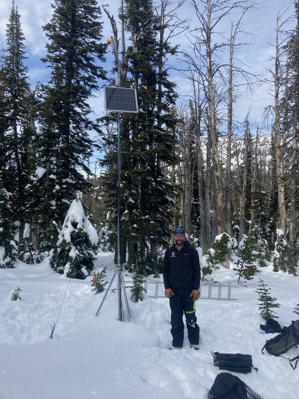
Went to do maintenance on the Sawtelle Snowfall weather station at 8800 ft just off the Sawtelle Mountain Road. Continuous snowcover starts around 8000 ft. At 8800 ft there is ~20" of snow with a mix of hard crusts and weak facets. These weak layers near the ground will be something to watch once snows again. Photo: GNFAC
Trip Planning for Island Park

Primary Problem: None
Bottom Line: Spring weather can be highly variable and create a mix of avalanche problems to watch out for. Snow conditions and snow stability can change drastically from day to day or hour to hour. Anticipate rapid change and plan accordingly. Plenty of snowfall over the winter with more spring snow to come makes avalanches possible into summer.Past 5 Days
Fri Apr 19

None
None
Mon Apr 22
None
None
Fri Apr 26
None
None
Mon Apr 29
None
None
Thu May 2
None
None
Relevant Avalanche Activity
Cooke City
Republic Mountain
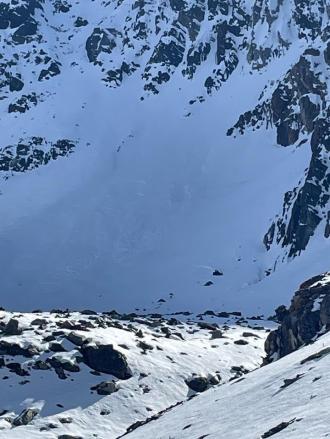
Skier triggered large Wet loose on the fin
Republic Mountain
L-ASu-R2-D2-I
Elevation: 10,000
Aspect: E
Coordinates: 45.0003, -109.9540
Caught: 0 ; Buried: 0
More Avalanche Details
L-ASu-R2-D2-I
Elevation: 10,000
Aspect: E
Coordinates: 45.0003, -109.9540
Caught: 0 ; Buried: 0
From obs.: “Our party (3) triggered a significant wet loose slide on the fin today. I, the first skier dropped in next to existing tracks from earlier in the morning. I made a couple of small turns in unskied snow to test it and decided that not much was moving. As I continued down the wet surface snow started to slide and accumulate. My partner called me on the radio to tell me a lot of snow was moving behind me and I cut left. I traversed hard to lower angle terrain until I felt I could safely descend the rest of the slope. My partners descended the bed surface until they could traverse out.
We made several key mistakes today. We knew it would be warm and that we should be up and down early. We left later than planned, moved slower than expected and failed to adjust our plan. We mistook lack of wet loose activity on similar aspects and elevations on features we could see as sign of stability. We failed to make a plan B or establish a turnaround time. We interpreted a party ahead of us that skied the slope as a go ahead. Another party approaching behind us added pressure to go. They also skied the slope after us in similar style to my partners.
In our favor, we communicated well, radios were key, stayed calm and we managed ourselves through the situation. I feel humbled and lucky to have gotten away with a free lesson. One that I didn't think I should have needed.”
More Avalanche Details
Relevant Photos
Displaying 41 - 46
-
-
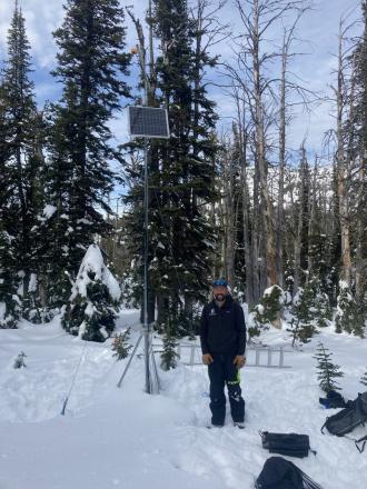
Went to do maintenance on the Sawtelle Snowfall weather station at 8800 ft just off the Sawtelle Mountain Road. Continuous snowcover starts around 8000 ft. At 8800 ft there is ~20" of snow with a mix of hard crusts and weak facets. These weak layers near the ground will be something to watch once snows again. Photo: GNFAC
-
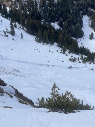
From IG: “Pine creek today, some small wind slabs and a full depth wet slide off black mountain”
-
From IG: “Pine creek today (10/21), some small wind slabs and a full depth wet slide off black mountain”
-
From obs. "Was out alpine climbing today and observed the north face of Blackmore had slid already."
-

Get your tickets and online bid for items HERE!


Videos- Island Park

Weather Stations- Island Park
Weather Forecast Island Park
Extended Forecast for10 Miles ESE Lakeview MT
Winter Storm Warning May 8, 02:46pm until May 9, 12:00amClick here for hazard details and duration Winter Storm Warning-
Winter Storm Warning May 8, 02:46pm until May 9, 12:00am
NOW until 12:00am Thu

Winter Storm Warning
This Afternoon

High: 37 °F
Chance Snow
and BreezyTonight

Low: 29 °F
Chance Snow
and BlusteryThursday
High: 45 °F
Slight Chance
Snow then
Chance
Rain/SnowThursday Night

Low: 27 °F
Mostly Clear
Friday

High: 53 °F
Sunny
Friday Night
Low: 31 °F
Mostly Clear
Saturday
High: 57 °F
Sunny
Saturday Night
Low: 35 °F
Mostly Clear
The Last Word
We began daily forecasts on December 7. 130 daily forecasts and 464 reported avalanches later, we wrapped up our daily forecasting season on April 14th. Read our SEASON SUMMARY to look back at the 2023-24 avalanche forecasting season.
Thank you to everyone that sent in observations, read the advisories, took an avalanche class, or donated money, time or gear. Our success is directly related to support from the community and the Forest Service. Have a safe spring and summer!